

Nairobi topographic map
Click on the map to display elevation.
Nairobi
Nairobi was founded in 1899 by colonial authorities in British East Africa, as a rail depot on the Uganda - Kenya Railway. The town quickly grew to replace Mombasa as the capital of Kenya in 1907. After independence in 1963, Nairobi became the capital of the Republic of Kenya. During Kenya's colonial period, the city became a centre for the colony's coffee, tea and sisal industry. The city lies in the south central part of Kenya, at an elevation of 1,795 metres (5,889 ft).
About this map
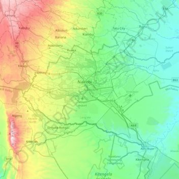
Name: Nairobi topographic map, elevation, terrain.
Location: Nairobi, Nairobi County, Kenya (-1.44488 36.66470 -1.16067 37.10487)
Average elevation: 1,729 m
Minimum elevation: 1,456 m
Maximum elevation: 2,442 m