
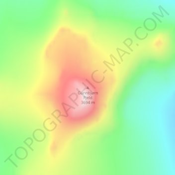
Gunnbjørn Fjeld topographic map
Interactive map
Click on the map to display elevation.
About this map
Name: Gunnbjørn Fjeld topographic map, elevation, terrain.
Location: Gunnbjørn Fjeld, Sermersooq, Greenland (68.91936 -29.89859 68.91946 -29.89849)
Average elevation: 3,251 m
Minimum elevation: 2,979 m
Maximum elevation: 3,686 m
Other topographic maps
Click on a map to view its topography, its elevation and its terrain.
Jakobshavn Glacier
Jakobshavn Glacier, Avannaata, Greenland
Average elevation: 452 m
Ittoqqortoormiit
Ittoqqortoormiit, Sermersooq, 3980, Greenland
Average elevation: 80 m
Kangerlussuaq
Kangerlussuaq, Sisimiut, Qeqqata, Greenland
Average elevation: 114 m
Traill-iup Immikkeertivi
Traill-iup Immikkeertivi, Sermersooq, Greenland
Average elevation: 0 m
Geographical Society Island
Geographical Society Island, Sermersooq, Greenland
Average elevation: 178 m