
Megha topographic map
Interactive map
Click on the map to display elevation.
About this map
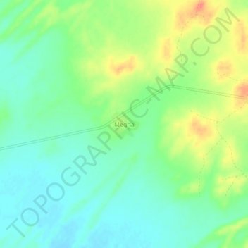
Name: Megha topographic map, elevation, terrain.
Location: Megha, Fatehgarh Tehsil, Jaisalmer District, Rajasthan, India (26.53178 70.96926 26.57178 71.00926)
Average elevation: 268 m
Minimum elevation: 250 m
Maximum elevation: 297 m
Other topographic maps
Click on a map to view its topography, its elevation and its terrain.
Desert National Park (Thar)
India > Rajasthan > Fatehgarh Tehsil
Desert National Park (Thar), Fatehgarh Tehsil, Jaisalmer District, Rajasthan, 345027, India
Average elevation: 164 m
Lakha
India > Rajasthan > Fatehgarh Tehsil
Lakha, Fatehgarh Tehsil, Jaisalmer District, Rajasthan, India
Average elevation: 272 m
Bhopa
India > Rajasthan > Fatehgarh Tehsil > Bhopa
Bhopa, Fatehgarh Tehsil, Jaisalmer, Rajasthan, India
Average elevation: 272 m