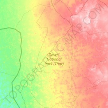
Desert National Park (Thar) topographic map
Interactive map
Click on the map to display elevation.
About this map
Other topographic maps
Click on a map to view its topography, its elevation and its terrain.
![Lakha topographic map, elevation, terrain](/pub/maps/node/4zgt/cbsv9nt6/icon.jpg)
Lakha
India > Rajasthan > Fatehgarh Tehsil
Lakha, Fatehgarh Tehsil, Jaisalmer District, Rajasthan, India
Average elevation: 272 m
![Megha topographic map, elevation, terrain](/pub/maps/node/fcb3/8pms5kcz/icon.jpg)
Megha
India > Rajasthan > Fatehgarh Tehsil
Megha, Fatehgarh Tehsil, Jaisalmer District, Rajasthan, India
Average elevation: 268 m
![Bhopa topographic map, elevation, terrain](/pub/maps/node/623l/kf7xvqgp/icon.jpg)
Bhopa
India > Rajasthan > Fatehgarh Tehsil > Bhopa
Bhopa, Fatehgarh Tehsil, Jaisalmer, Rajasthan, India
Average elevation: 272 m