
Make a donation
Gear up for your next adventure:
As an Amazon Associate, this site earns from qualifying purchases at no extra cost to you.
Brousek topographic map
Click on the map to display elevation.
Make a donation
Gear up for your next adventure:
As an Amazon Associate, this site earns from qualifying purchases at no extra cost to you.
About this map
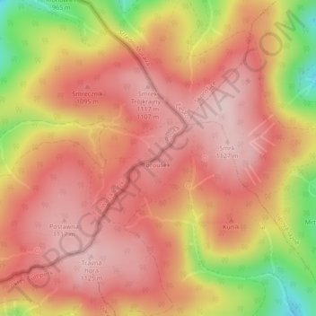
Name: Brousek topographic map, elevation, terrain.
Average elevation: 1,040 m
Minimum elevation: 864 m
Maximum elevation: 1,124 m
Make a donation
Gear up for your next adventure:
As an Amazon Associate, this site earns from qualifying purchases at no extra cost to you.
Other topographic maps
Click on a map to view its topography, its elevation and its terrain.
Kudowa-Zdrój
Poland > Lower Silesian Voivodeship > Kłodzko County > Kudowa-Zdrój
Average elevation: 510 m
Make a donation
Gear up for your next adventure:
As an Amazon Associate, this site earns from qualifying purchases at no extra cost to you.
Make a donation
Gear up for your next adventure:
As an Amazon Associate, this site earns from qualifying purchases at no extra cost to you.
Make a donation
Gear up for your next adventure:
As an Amazon Associate, this site earns from qualifying purchases at no extra cost to you.
Make a donation
Gear up for your next adventure:
As an Amazon Associate, this site earns from qualifying purchases at no extra cost to you.
Lewin Kłodzki
Poland > Lower Silesian Voivodeship > Kłodzko County
It was then that a timber watchtower was constructed on Gródek Hill, at an altitude of 522 meters above sea level. The lone tower was not a usual border keep with a strong military garrison, but a rather insignificant checkpoint guarding the trade route which passed through Lewin. Over time, various…
Average elevation: 516 m
Make a donation
Gear up for your next adventure:
As an Amazon Associate, this site earns from qualifying purchases at no extra cost to you.
Kudowa-Zdrój
Poland > Lower Silesian Voivodeship > Kłodzko County > Kudowa-Zdrój
Average elevation: 510 m
Make a donation
Gear up for your next adventure:
As an Amazon Associate, this site earns from qualifying purchases at no extra cost to you.
Długopole-Zdrój
Poland > Lower Silesian Voivodeship > Kłodzko County > Długopole-Zdrój
Average elevation: 422 m