
Dion topographic map
Interactive map
Click on the map to display elevation.
About this map
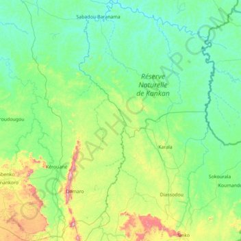
Name: Dion topographic map, elevation, terrain.
Location: Dion, Beyla Prefecture, Nzérékoré, Guinea (8.84339 -8.87806 10.22129 -8.51525)
Average elevation: 537 m
Minimum elevation: 369 m
Maximum elevation: 1,478 m
Other topographic maps
Click on a map to view its topography, its elevation and its terrain.