
Saint John River topographic map
Interactive map
Click on the map to display elevation.
About this map
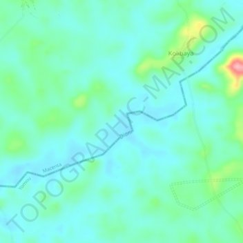
Name: Saint John River topographic map, elevation, terrain.
Location: Saint John River, Yomou Prefecture, Nzérékoré, Guinea (7.81905 -9.28866 7.84371 -9.24629)
Average elevation: 431 m
Minimum elevation: 405 m
Maximum elevation: 537 m
Other topographic maps
Click on a map to view its topography, its elevation and its terrain.
Diani
Guinea > Nzérékoré > Macenta Prefecture
Diani, Macenta Prefecture, Nzérékoré, Guinea
Average elevation: 485 m
Gueckedou Centre
Guinea > Nzérékoré > Gueckedou Centre
Gueckedou Centre, Guéckédou Prefecture, Nzérékoré, Guinea
Average elevation: 460 m