Geolocate

Stellendam topographic map

Click on the map to display elevation.

About this map
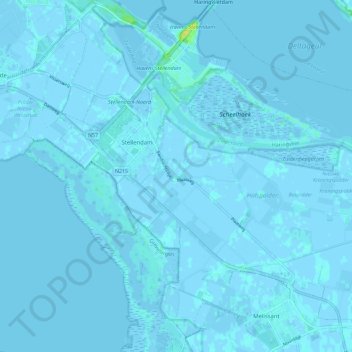
Name: Stellendam topographic map, elevation, terrain.

Location: Stellendam, Goeree-Overflakkee, South Holland, Netherlands (51.76294 3.98901 51.83295 4.08734)

Average elevation: 0 m

Minimum elevation: -5 m

Maximum elevation: 16 m

Other topographic maps

Click on a map to view its topography, its elevation and its terrain.

Tweede Tol

Netherlands > South Holland > Dordrecht

Average elevation: 0 m

Gooland

Netherlands > South Holland > Nootdorp

Average elevation: -2 m

Botlek

Netherlands > South Holland

Average elevation: 3 m

Langeraar

Netherlands > South Holland

Average elevation: -3 m

Waalhaven

Netherlands > South Holland > Rotterdam

Average elevation: 3 m

Meijendel

Netherlands > South Holland > Wassenaar

Average elevation: 6 m

Meije

Netherlands > South Holland > Nieuwkoop

Average elevation: -2 m

Ankerpark

Netherlands > South Holland > Leiden

Average elevation: 3 m

Weerestein

Netherlands > South Holland > Hillegom

Average elevation: 0 m

Weerestein

Netherlands > South Holland > Hillegom

Average elevation: 0 m

Coepelduynen

Netherlands > South Holland > Katwijk

Average elevation: 4 m

Middelsluis

Netherlands > South Holland > Numansdorp

Average elevation: 0 m

Broekhuizen

Netherlands > South Holland > Gouda

Average elevation: -1 m

Het Park

Netherlands > South Holland > Rotterdam

Average elevation: 4 m

Gear up for your next adventure:

🧢Thermal Beanie Hats - Prevent heat loss from the head in windy summit conditions
🧣Fleece Neck Warmers - Extra insulation for winter topographic surveys
🧷Tenacious Repair Tape - Instant fix for torn tents, jackets, or dry bags
🛰️Outdoor GPS Navigation - Navigation devices for remote and off-grid areas
🧼Camping Hygiene Kits - Compact hygiene essentials for outdoor stays

As an Amazon Associate, this site earns from qualifying purchases at no extra cost to you.