
Upernivik Island topographic map
Interactive map
Click on the map to display elevation.
About this map
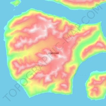
Name: Upernivik Island topographic map, elevation, terrain.
Location: Upernivik Island, Avannaata, Greenland (71.15375 -53.17926 71.38277 -52.33741)
Average elevation: 600 m
Minimum elevation: -1 m
Maximum elevation: 1,918 m
Other topographic maps
Click on a map to view its topography, its elevation and its terrain.