
Hương Khê District topographic map
Interactive map
Click on the map to display elevation.
About this map
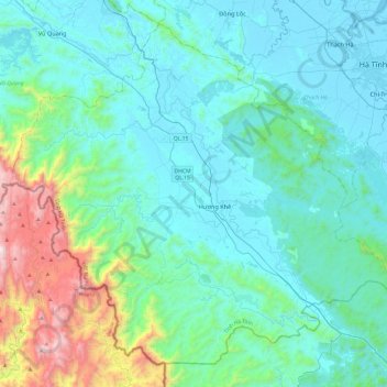
Name: Hương Khê District topographic map, elevation, terrain.
Location: Hương Khê District, Hà Tĩnh Province, 46003, Vietnam (17.99186 105.45165 18.39347 105.93151)
Average elevation: 262 m
Minimum elevation: -1 m
Maximum elevation: 1,620 m
Other topographic maps
Click on a map to view its topography, its elevation and its terrain.