
Can Lộc District topographic map
Interactive map
Click on the map to display elevation.
About this map
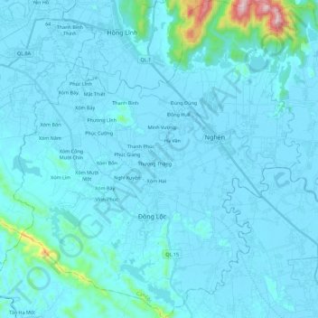
Name: Can Lộc District topographic map, elevation, terrain.
Location: Can Lộc District, Ha Tinh Province, Vietnam (18.33768 105.62990 18.54944 105.83251)
Average elevation: 39 m
Minimum elevation: -2 m
Maximum elevation: 662 m
Other topographic maps
Click on a map to view its topography, its elevation and its terrain.
Hương Khê District
Hương Khê District, Hà Tĩnh Province, 46003, Vietnam
Average elevation: 262 m
Vĩnh Phúc
Vietnam > Ha Tinh Province > Vĩnh Phúc
Vĩnh Phúc, Can Lộc District, Ha Tinh Province, Vietnam
Average elevation: 13 m
Hương Sơn District
Hương Sơn District, Ha Tinh Province, Vietnam
Average elevation: 513 m