Hinton topographic map
Click on the map to display elevation.
Hinton
Hinton is located in northeastern Caddo County at an elevation of 1,676 feet (511 m). The town limits extend north from the settled part of town 4 miles (6 km) along U.S. Route 281 to Interstate 40 at Exit 101, from which it is 49 miles (79 km) east to the center of Oklahoma City.
About this map
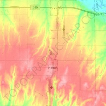
Name: Hinton topographic map, elevation, terrain.
Location: Hinton, Caddo County, Oklahoma, United States (35.43482 -98.37679 35.53626 -98.34174)
Average elevation: 482 m
Minimum elevation: 416 m
Maximum elevation: 523 m
Other topographic maps
Click on a map to view its topography, its elevation and its terrain.


Red Rock Canyon Adventure Park
United States > Oklahoma > Caddo County > Hinton
Average elevation: 492 m