Geolocate

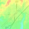
Three-Way Corner topographic map

Click on the map to display elevation.

About this map

Name: Three-Way Corner topographic map, elevation, terrain.

Location: Three-Way Corner, Caddo County, Oklahoma, United States (35.27089 -98.43200 35.31089 -98.39200)

Average elevation: 467 m

Minimum elevation: 437 m

Maximum elevation: 485 m

Other topographic maps

Click on a map to view its topography, its elevation and its terrain.

Hinton

United States > Oklahoma > Caddo County

Hinton is located in northeastern Caddo County at an elevation of 1,676 feet (511 m). The town limits extend north from the settled part of town 4 miles (6 km) along U.S. Route 281 to Interstate 40 at Exit 101, from which it is 49 miles (79 km) east to the center of Oklahoma City.

Average elevation: 482 m

Apache

United States > Oklahoma > Caddo County

Average elevation: 390 m

Cyril

United States > Oklahoma > Caddo County

Average elevation: 415 m

Anadarko

United States > Oklahoma > Caddo County

Average elevation: 369 m

Anadarko

United States > Oklahoma > Caddo County

Average elevation: 369 m

Apache

United States > Oklahoma > Caddo County

Average elevation: 390 m

Fort Cobb

United States > Oklahoma > Caddo County > Fort Cobb

Average elevation: 390 m

Gear up for your next adventure:

🧗Locking Carabiners - Secure gear to your pack or for light technical use
🧦Merino Wool Hiking Socks - Moisture-wicking socks to prevent blisters during long mountain walks
📚UK Hiking Guidebooks - Detailed route descriptions for the Lake District, Peaks, and Highlands
🖼️Topographic Map Art - Decorative 3D-effect posters of famous UK peaks and regions
🧤Thermal Touchscreen Gloves - Stay warm while operating your GPS or smartphone camera

As an Amazon Associate, this site earns from qualifying purchases at no extra cost to you.