Geolocate

Apache topographic map

Click on the map to display elevation.

About this map
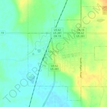
Name: Apache topographic map, elevation, terrain.

Location: Apache, Caddo County, Oklahoma, United States (34.88028 -98.37437 34.90589 -98.33898)

Average elevation: 390 m

Minimum elevation: 378 m

Maximum elevation: 408 m

Other topographic maps

Click on a map to view its topography, its elevation and its terrain.

Nowhere

United States > Oklahoma > Caddo County

Average elevation: 411 m

Three-Way Corner

United States > Oklahoma > Caddo County

Average elevation: 467 m

Gear up for your next adventure:

🔭Compact Hiking Binoculars - Lightweight optics for scouting terrain and spotting wildlife
🥤Collapsible Water Bottles - Save space in your rucksack as you consume your water
🧭Emergency Beacons - Safety beacons for remote outdoor locations
🥾Trekking Poles - Poles to improve stability on uneven terrain
📱Phone Mounts for Hiking - Secure mounts to carry your phone on trails

As an Amazon Associate, this site earns from qualifying purchases at no extra cost to you.