Geolocate

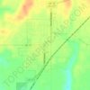
Nowhere topographic map

Click on the map to display elevation.

About this map

Name: Nowhere topographic map, elevation, terrain.

Location: Nowhere, Caddo County, Oklahoma, United States (35.13923 -98.46228 35.17923 -98.42228)

Average elevation: 411 m

Minimum elevation: 388 m

Maximum elevation: 435 m

Other topographic maps

Click on a map to view its topography, its elevation and its terrain.

Hinton

United States > Oklahoma > Caddo County

Hinton is located in northeastern Caddo County at an elevation of 1,676 feet (511 m). The town limits extend north from the settled part of town 4 miles (6 km) along U.S. Route 281 to Interstate 40 at Exit 101, from which it is 49 miles (79 km) east to the center of Oklahoma City.

Average elevation: 482 m

Apache

United States > Oklahoma > Caddo County

Average elevation: 390 m

Cyril

United States > Oklahoma > Caddo County

Average elevation: 415 m

Anadarko

United States > Oklahoma > Caddo County

Average elevation: 369 m

Anadarko

United States > Oklahoma > Caddo County

Average elevation: 369 m

Apache

United States > Oklahoma > Caddo County

Average elevation: 390 m

Fort Cobb

United States > Oklahoma > Caddo County > Fort Cobb

Average elevation: 390 m

Gear up for your next adventure:

☕Insulated Travel Mugs - Keep drinks hot while surveying the landscape from a summit
🐕Hiking Dog Harnesses - Rugged harnesses for taking your companion on mountain trails
🐕Dog Hiking Gear - Equipment for hiking safely with dogs
🦟Anti-Midge & Tick Repellent - Vital for hiking in the Scottish Highlands during summer
🧤Waterproof Overmitts - Extreme weather protection for hikers and mountaineers

As an Amazon Associate, this site earns from qualifying purchases at no extra cost to you.