
Amadjuak Lake topographic map
Interactive map
Click on the map to display elevation.
About this map
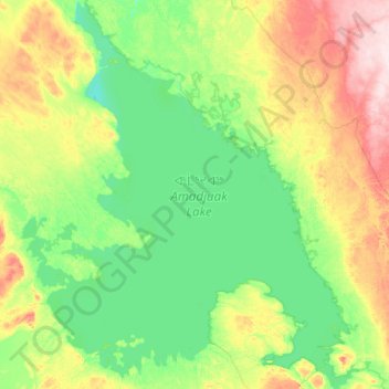
Name: Amadjuak Lake topographic map, elevation, terrain.
Location: Amadjuak Lake, Nunavut, Kanada (64.56250 -72.06089 65.41521 -70.30329)
Average elevation: 139 m
Minimum elevation: 94 m
Maximum elevation: 329 m
Other topographic maps
Click on a map to view its topography, its elevation and its terrain.