
Alexander Island topographic map
Interactive map
Click on the map to display elevation.
About this map
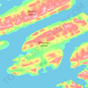
Name: Alexander Island topographic map, elevation, terrain.
Location: Alexander Island, Nunavut, Kanada (75.74800 -103.38600 76.00050 -101.96900)
Average elevation: 47 m
Minimum elevation: -1 m
Maximum elevation: 212 m
Other topographic maps
Click on a map to view its topography, its elevation and its terrain.