Geolocate

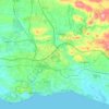
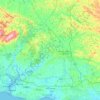
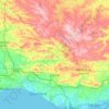
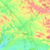
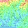
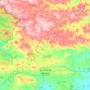
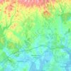
Lagoa topographic map

Click on the map to display elevation.

About this map
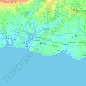
Name: Lagoa topographic map, elevation, terrain.

Location: Lagoa, Lagoa e Carvoeiro, Lagoa, Faro, 8400-343, Portugal (36.97629 -8.61408 37.29629 -8.29408)

Average elevation: 53 m

Minimum elevation: -5 m

Maximum elevation: 576 m

Other topographic maps

Click on a map to view its topography, its elevation and its terrain.
Albufeira

Portugal > Faro

Average elevation: 77 m

Aljezur

Portugal > Faro

Average elevation: 94 m

Boliqueime

Portugal > Faro > Loulé

Average elevation: 108 m

Lagos

Portugal > Faro

Average elevation: 57 m

Silves

Portugal > Faro

Average elevation: 158 m

Ferragudo

Portugal > Faro

Average elevation: 15 m

Armação de Pêra

Portugal > Faro

Average elevation: 33 m

Aljezur

Portugal > Faro

Average elevation: 94 m

Faro

Portugal > Faro

Average elevation: 67 m

Sagres

Portugal > Faro

Average elevation: 31 m

Praia da Luz

Portugal > Faro > Lagos

Average elevation: 34 m

Benafim

Portugal > Faro > Loulé

Average elevation: 245 m

Silves

Portugal > Faro

Average elevation: 158 m

Monchique

Portugal > Faro

Monchique has a Mediterranean climate with warm to hot summers and mild, wet winters. Due to its altitude and location, right between the valley formed by the Serra de Monchique, precipitation in the winter is much larger than anywhere else on the Algarve. Its position on the southwest corner of Portugal gives…

Average elevation: 206 m
Ferragudo

Portugal > Faro

Average elevation: 15 m

Lagos

Portugal > Faro

Average elevation: 57 m

Loulé

Portugal > Faro

Loulé is well known for the sandy beaches, such as Quarteira. Inland, Loulé shows a rich geology, paleontology, and wildlife. The seat of the municipality, the city of Loulé proper, is about 10 kilometres inland from the nearest coast at an elevation exceeding 100 meters and higher.

Average elevation: 222 m

Quarteira

Portugal > Faro

Average elevation: 29 m

Alvor

Portugal > Faro > Portimão

The Prince Regent ordered, in the name of Manuel of Portugal, the elevation of Alvor to vila (town) on 28 February 1495, which was confirmed in a secondary diploma on 28 December 1498.

Average elevation: 15 m

Monchique

Portugal > Faro

Monchique has a Mediterranean climate with warm to hot summers and mild, wet winters. Due to its altitude and location, right between the valley formed by the Serra de Monchique, precipitation in the winter is much larger than anywhere else on the Algarve. Its position on the southwest corner of Portugal gives…

Average elevation: 206 m
São Bartolomeu de Messines

Portugal > Faro

Average elevation: 170 m

Albufeira

Portugal > Faro

Average elevation: 77 m

Altura

Portugal > Faro > Castro Marim

Average elevation: 23 m

Marmelete

Portugal > Faro > Monchique

Average elevation: 231 m

Loulé (São Sebastião)

Portugal > Faro > Loulé

Average elevation: 145 m

Silves

Portugal > Faro

Average elevation: 158 m

Portimão

Portugal > Faro

The geographical distribution of the altitude and relief of the municipality of Portimão generically follow the three types of territory present in the Barlavento: the coastal region, the Barrocal (a region between the coastal region and the mountains) and the mountains up north. Each one with their own…

Average elevation: 67 m

Parchal

Portugal > Faro > Estômbar e Parchal > Parchal

Average elevation: 10 m

Alte

Portugal > Faro > Loulé

Average elevation: 232 m

Portimão

Portugal > Faro

The geographical distribution of the altitude and relief of the municipality of Portimão generically follow the three types of territory present in the Barlavento: the coastal region, the Barrocal (a region between the coastal region and the mountains) and the mountains up north. Each one with their own…

Average elevation: 67 m

Praia do Carvalho

Portugal > Faro > Lagoa

Average elevation: 25 m

Barão de São João

Portugal > Faro > Lagos

Average elevation: 85 m

Quelfes

Portugal > Faro > Olhão

Average elevation: 25 m

Almancil

Portugal > Faro

Due to an influx of tourism into the Algarve, the resident population of the parish expanded, resulting in the 18 December 1987 elevation of the parish to category of town.

Average elevation: 29 m

Aljezur

Portugal > Faro

Average elevation: 94 m

Faro

Portugal > Faro

Average elevation: 67 m

Olhão

Portugal > Faro

Over time the small town of fishermen grew into an economic, social and urban centre, resulting in its elevation in city in 1985. In recent years, it has also developed a growing tourist industry.

Average elevation: 69 m

Quarteira

Portugal > Faro

Average elevation: 29 m

Lagos

Portugal > Faro

Average elevation: 57 m

Moncarapacho

Portugal > Faro > Olhão

Average elevation: 59 m

Ilha da Armona

Portugal > Faro > Olhão > Moncarapacho

Average elevation: 6 m

Rogil

Portugal > Faro > Aljezur

Average elevation: 65 m

Vila do Bispo

Portugal > Faro

Average elevation: 38 m

Monchique

Portugal > Faro

Monchique has a Mediterranean climate with warm to hot summers and mild, wet winters. Due to its altitude and location, right between the valley formed by the Serra de Monchique, precipitation in the winter is much larger than anywhere else on the Algarve. Its position on the southwest corner of Portugal gives…

Average elevation: 206 m
Vila do Bispo

Portugal > Faro

Average elevation: 38 m

Albufeira

Portugal > Faro

Average elevation: 64 m

Budens

Portugal > Faro > Vila do Bispo

Average elevation: 74 m

Faro

Portugal > Faro

Average elevation: 67 m

São Brás de Alportel

Portugal > Faro

During the 19th century the parish became an important economic center. Cork oak plantations encouraged commercial development and made São Brás de Alportel the largest cork producing center in Portugal. At the beginning of the 20th century (1912), São Brás de Alportel was the most populated parish in the…

Average elevation: 322 m

Quarteira

Portugal > Faro

Average elevation: 29 m

Pechão

Portugal > Faro > Olhão

Average elevation: 28 m

Tavira

Portugal > Faro

Average elevation: 147 m

Praia Verde

Portugal > Faro > Castro Marim

Average elevation: 7 m

Mexilhoeira Grande

Portugal > Faro > Portimão

Average elevation: 83 m

Alte

Portugal > Faro > Loulé

Average elevation: 232 m

Almancil

Portugal > Faro

Due to an influx of tourism into the Algarve, the resident population of the parish expanded, resulting in the 18 December 1987 elevation of the parish to category of town.

Average elevation: 29 m

Silves

Portugal > Faro

Average elevation: 158 m

Martim Longo

Portugal > Faro

Average elevation: 244 m

Quarteira

Portugal > Faro

Average elevation: 29 m

Mexilhoeira Grande

Portugal > Faro > Portimão

Average elevation: 83 m

Jardim Vale Faro

Portugal > Faro > Albufeira

Average elevation: 32 m

Azinhal

Portugal > Faro > Castro Marim

Average elevation: 65 m

Moncarapacho

Portugal > Faro > Olhão

Average elevation: 59 m

Olhão

Portugal > Faro

Over time the small town of fishermen grew into an economic, social and urban centre, resulting in its elevation in city in 1985. In recent years, it has also developed a growing tourist industry.

Average elevation: 69 m

Fuseta

Portugal > Faro > Olhão

Average elevation: 5 m

Mexilhoeira Grande

Portugal > Faro > Portimão

Average elevation: 83 m

Alcoutim e Pereiro

Portugal > Faro

Average elevation: 141 m

Vaqueiros

Portugal > Faro

Average elevation: 250 m

Faro

Portugal > Faro

Average elevation: 67 m

Praia de Benagil

Portugal > Faro > Lagoa e Carvoeiro

Average elevation: 25 m

Vila do Bispo

Portugal > Faro

Average elevation: 38 m

Montenegro

Portugal > Faro > Faro

Average elevation: 8 m

Faro

Portugal > Faro

Average elevation: 67 m

Lagos

Portugal > Faro

Average elevation: 57 m

Rogil

Portugal > Faro > Aljezur

Average elevation: 65 m

Mexilhoeira Grande

Portugal > Faro > Portimão

Average elevation: 83 m

São Bartolomeu de Messines

Portugal > Faro

Average elevation: 170 m

Portimão

Portugal > Faro

The geographical distribution of the altitude and relief of the municipality of Portimão generically follow the three types of territory present in the Barlavento: the coastal region, the Barrocal (a region between the coastal region and the mountains) and the mountains up north. Each one with their own…

Average elevation: 67 m
Olhão

Portugal > Faro

Over time the small town of fishermen grew into an economic, social and urban centre, resulting in its elevation in city in 1985. In recent years, it has also developed a growing tourist industry.

Average elevation: 4 m

Faro (Sé e São Pedro)

Portugal > Faro > Faro

Average elevation: 17 m

Gear up for your next adventure:

🧰First Aid Kits - Essential safety kits for outdoor activities
🧴Tick Removal Tools - Small, essential health tool for UK woodland and moorland
🧊Insulated Flasks - Keeps drinks hot or cold during hikes
🔭Compact Hiking Binoculars - Lightweight optics for scouting terrain and spotting wildlife
👕Merino Base Layers - Natural temperature regulation for cold weather hiking and camping

As an Amazon Associate, this site earns from qualifying purchases at no extra cost to you.