
Redwater topographic map
Interactive map
Click on the map to display elevation.
About this map
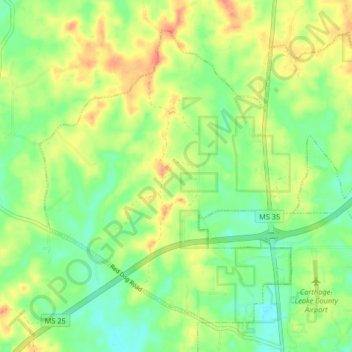
Name: Redwater topographic map, elevation, terrain.
Location: Redwater, Leake County, Mississippi, United States (32.75350 -89.59480 32.81066 -89.51297)
Average elevation: 131 m
Minimum elevation: 105 m
Maximum elevation: 164 m
Other topographic maps
Click on a map to view its topography, its elevation and its terrain.
Carthage
United States > Mississippi > Leake County
Carthage, Leake County, Mississippi, United States
Average elevation: 117 m
Lena
United States > Mississippi > Leake County > Lena
Lena, Leake County, Mississippi, United States
Average elevation: 112 m
Standing Pine
United States > Mississippi > Leake County
Standing Pine, Leake County, Mississippi, United States
Average elevation: 127 m