Geolocate

Soi Dao topographic map

Interactive map

Click on the map to display elevation.

About this map

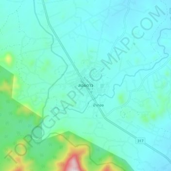
Name: Soi Dao topographic map, elevation, terrain.

Location: Soi Dao, Chanthaburi Province, Thailand (13.08657 102.17337 13.16657 102.25337)

Average elevation: 274 m

Minimum elevation: 184 m

Maximum elevation: 808 m

Other topographic maps

Click on a map to view its topography, its elevation and its terrain.

Bang Kacha

Thailand > Chanthaburi Province

Bang Kacha, Khai Noen Wong, Chanthaburi Province, 22120, Thailand

Average elevation: 9 m

Na Yai Am

Thailand > Chanthaburi Province

Na Yai Am, Chang Kham, Chanthaburi Province, 22160, Thailand

Average elevation: 13 m

Khlong Phlu

Thailand > Chanthaburi Province

Khlong Phlu, Chanthaburi Province, Thailand

Average elevation: 238 m

Khao Baisi

Thailand > Chanthaburi Province

Khao Baisi, Chanthaburi Province, 22120, Thailand

Average elevation: 19 m

Khao Wua–Phloi Waen

Thailand > Chanthaburi Province

Khao Wua–Phloi Waen, Chanthaburi Province, 22120, Thailand

Average elevation: 37 m

Phlapphla

Thailand > Chanthaburi Province

Phlapphla, Chanthaburi Province, 22000, Thailand

Average elevation: 59 m

Laem Sing

Thailand > Chanthaburi Province

Laem Sing, Ko Khwang, Chanthaburi Province, Thailand

Average elevation: 2 m

Phlio

Thailand > Chanthaburi Province

Phlio, Kwian Hak, Chanthaburi Province, Thailand

Average elevation: 18 m

Tha Chang

Thailand > Chanthaburi Province

Tha Chang, Salaeng, Chanthaburi Province, Thailand

Average elevation: 16 m

Pluang Dam

Thailand > Chanthaburi Province

Pluang Dam, Wang Saem, Chanthaburi Province, Thailand

Average elevation: 63 m

Chanthaburi

Thailand > Chanthaburi Province

Chanthaburi, Phlapphla Narai, Chanthaburi Province, 22000, Thailand

Average elevation: 7 m

Sanam Chai

Thailand > Chanthaburi Province

Sanam Chai, Chanthaburi Province, Thailand

Average elevation: 12 m