
川崎町 topographic map
Interactive map
Click on the map to display elevation.
About this map
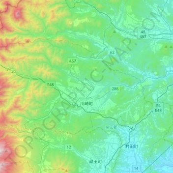
Name: 川崎町 topographic map, elevation, terrain.
Location: 川崎町, 柴田郡, 宫城县, 日本 (38.13373 140.44589 38.26754 140.74967)
Average elevation: 351 m
Minimum elevation: 5 m
Maximum elevation: 1,624 m
Other topographic maps
Click on a map to view its topography, its elevation and its terrain.