
柴田町 topographic map
Interactive map
Click on the map to display elevation.
About this map
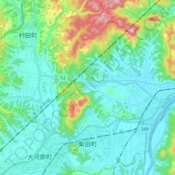
Name: 柴田町 topographic map, elevation, terrain.
Location: 柴田町, 柴田郡, 宫城县, 日本 (38.03870 140.74302 38.13827 140.83494)
Average elevation: 59 m
Minimum elevation: 2 m
Maximum elevation: 283 m
Other topographic maps
Click on a map to view its topography, its elevation and its terrain.