
Broka topographic map
Interactive map
Click on the map to display elevation.
About this map
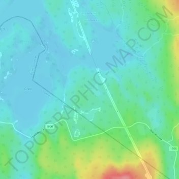
Name: Broka topographic map, elevation, terrain.
Location: Broka, Gran, Innlandet, Norway (60.32711 10.73577 60.32910 10.74051)
Average elevation: 440 m
Minimum elevation: 420 m
Maximum elevation: 511 m
Other topographic maps
Click on a map to view its topography, its elevation and its terrain.
Scandinavian Mountains
The mountain chain's highest summits are mostly concentrated in an area (of mean altitude of over 1,000 m) between Stavanger and Trondheim in South Norway, with numerous peaks over 1,300 m and some peaks over 2,000 m. Around Trondheim Fjord, peaks decrease in altitude to about 400–500 m rising again to…
Average elevation: 2,050 m
Galdhøpiggen
At Juvasshytta there is an alpine ski resort with lift on a glacier, reaching an elevation of 2,200 metres (7,200 ft) above sea level, the highest in Scandinavia. It is called Galdhøpiggen Summer Ski Centre and is open from June and all the summer when the road is open.
Average elevation: 2,105 m
Dovre
The Dovre area is in a valley at fairly high altitude and isolated from the sea by mountain ranges, giving some rain shadow effect for Dovre. Dovre, with the town Dombås, has a subarctic climate (Dfc) with sparse precipitation. The driest season is late winter and spring, and the wettest season is summer.…
Average elevation: 1,195 m
Galdhøpiggen
At Juvasshytta there is an alpine ski resort with lift on a glacier, reaching an elevation of 2,200 metres (7,200 ft) above sea level, the highest in Scandinavia. It is called Galdhøpiggen Summer Ski Centre and is open from June and all the summer when the road is open.
Average elevation: 2,105 m
Glittertinden
The mountain reaches an elevation of 2,452 metres (8,045 ft) without the glacier on top of its peak. As of 2008 it reached 2,465 metres (8,087 ft) above sea level including the glacier, measured as summer minimum. But in August 2022, the mountain was seen basically without the glacier.
Average elevation: 2,135 m