
Beihai topographic map
Interactive map
Click on the map to display elevation.
About this map
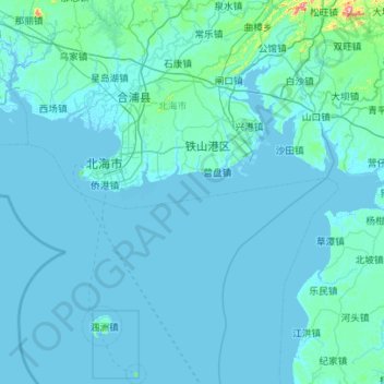
Name: Beihai topographic map, elevation, terrain.
Location: Beihai, Guangxi, China (20.88442 108.84383 21.92143 109.78417)
Average elevation: 16 m
Minimum elevation: -2 m
Maximum elevation: 619 m
Other topographic maps
Click on a map to view its topography, its elevation and its terrain.
Hechi
Hechi is located in northwestern Guangxi on the southern end of the Yunnan-Guizhou Plateau. The total area is 33,500 km2 (12,900 sq mi), with elevations increasing from southeast to northwest. It is very mountainous with ranges including in the north the Jiuwanda Mountains, in the northwest the Phoenix…
Average elevation: 257 m