
Zone Portuaire topographic map
Interactive map
Click on the map to display elevation.
About this map
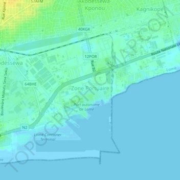
Name: Zone Portuaire topographic map, elevation, terrain.
Location: Zone Portuaire, Lomé, 3e Arrondissement, Togo (6.13158 1.26623 6.16379 1.30574)
Average elevation: 4 m
Minimum elevation: -3 m
Maximum elevation: 21 m
Other topographic maps
Click on a map to view its topography, its elevation and its terrain.
Baie d'Atikoumé
Baie d'Atikoumé, Akossombo, Lomé, 5e Arrondissement, Togo
Average elevation: 21 m