
Uppingham topographic map
Click on the map to display elevation.
About this map
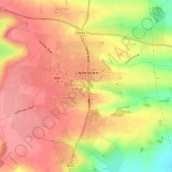
Name: Uppingham topographic map, elevation, terrain.
Location: Uppingham, Rutland, England, United Kingdom (52.57576 -0.75403 52.59670 -0.70239)
Average elevation: 135 m
Minimum elevation: 70 m
Maximum elevation: 167 m
Rutland trails, hiking, mountain biking, running and outdoor activities
Other topographic maps
Click on a map to view its topography, its elevation and its terrain.