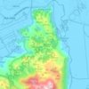
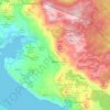
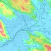
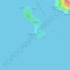
Gradina topographic map
Click on the map to display elevation.
About this map

Name: Gradina topographic map, elevation, terrain.
Average elevation: 28 m
Minimum elevation: 0 m
Maximum elevation: 172 m
Other topographic maps
Click on a map to view its topography, its elevation and its terrain.
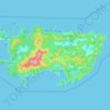
Lastovo
Croatia > Dubrovnik-Neretva County > Općina Lastovo
Since records began in 1949, the highest temperature recorded at the local weather station at an elevation of 186 metres (610 ft) was 38.3 °C (100.9 °F), on 3 August 1998. The coldest temperature was −6.8 °C (19.8 °F), on 23 January 1963.
Average elevation: 35 m
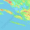
Pelješac
Croatia > Dubrovnik-Neretva County
The Peninsula is part of the Tyrrhenian–Adriatic sclerophyllous and mixed forests ecoregion, in the Mediterranean forests, woodlands, and scrub biome. Forests and woodlands are dominated by Aleppo pine Pinus halepensis, kermes oak Quercus coccifera and holm oak Quercus ilex with maquis shrubs and deciduous…
Average elevation: 90 m




Općina Lumbarda
Croatia > Dubrovnik-Neretva County
The lack of early Middle Ages ruins confirms the theory that with the fall of the Antic age, Lumbarda was all but abandoned (and later resettled). Its current name first appears in the statute of Korčula, originally compiled in 1214 (suggesting a presence of a trading post)[1] . Consequently, one of the…
Average elevation: 18 m

Lastovo
Croatia > Dubrovnik-Neretva County > Općina Lastovo
Since records began in 1949, the highest temperature recorded at the local weather station at an elevation of 186 metres (610 ft) was 38.3 °C (100.9 °F), on 3 August 1998. The coldest temperature was −6.8 °C (19.8 °F), on 23 January 1963.
Average elevation: 35 m

Dubrovnik
Croatia > Dubrovnik-Neretva County
Since records began in 1961, the highest temperature recorded at the local weather station at an elevation of 52 metres (171 ft) was 38.9 °C (102.0 °F), on 13 August 2025. The coldest temperature was −7.0 °C (19.4 °F), on 14 January 1968.
Average elevation: 297 m
Grad Ploče
Croatia > Dubrovnik-Neretva County
Ploče at an elevation of 2 metres (6.6 ft) is the location of Croatia's high temperature record, measured at 42.8 °C (109.0 °F) on 4 and 5 August 1981. Records for the Ploče weather station began in 1975. The coldest temperature was −8.9 °C (16.0 °F), on 13 January 1985.
Average elevation: 140 m