
Bujagali topographic map
Interactive map
Click on the map to display elevation.
About this map
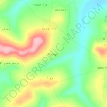
Name: Bujagali topographic map, elevation, terrain.
Location: Bujagali, Kalungu, Central Region, Uganda (-0.12540 31.79244 -0.08540 31.83244)
Average elevation: 1,232 m
Minimum elevation: 1,162 m
Maximum elevation: 1,329 m
Other topographic maps
Click on a map to view its topography, its elevation and its terrain.