
Knockvennie Smithy topographic map
Interactive map
Click on the map to display elevation.
About this map
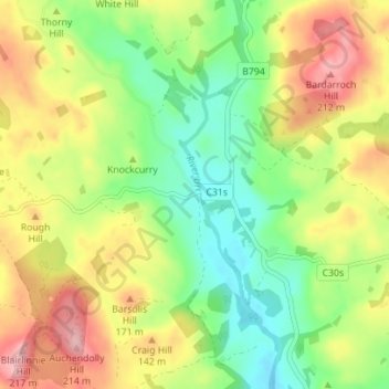
Name: Knockvennie Smithy topographic map, elevation, terrain.
Average elevation: 121 m
Minimum elevation: 49 m
Maximum elevation: 215 m
Routes: Dumfries and Galloway GPS tracks, routes, trails, hikes
Other topographic maps
Click on a map to view its topography, its elevation and its terrain.
Lochmaben Castle
United Kingdom > Scotland > Dumfries and Galloway > Lochmaben
Average elevation: 48 m
Glentrool Village
United Kingdom > Scotland > Dumfries and Galloway > Glentrool Village
Average elevation: 116 m