
Avunatari Centre topographic map
Interactive map
Click on the map to display elevation.
About this map
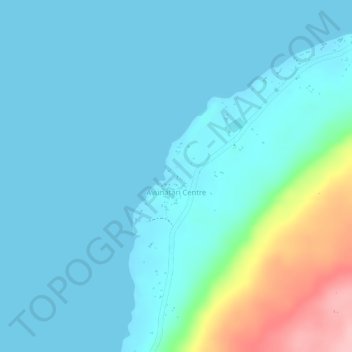
Name: Avunatari Centre topographic map, elevation, terrain.
Location: Avunatari Centre, Sanma, Vanuatu (-15.64545 167.09094 -15.63986 167.09476)
Average elevation: 29 m
Minimum elevation: 0 m
Maximum elevation: 172 m
Other topographic maps
Click on a map to view its topography, its elevation and its terrain.
Malo Island
Vanuatu > Sanma > Luganville
Malo Island, Luganville, Sanma, Vanuatu
Average elevation: 50 m