
Oodweyne District topographic map
Interactive map
Click on the map to display elevation.
About this map
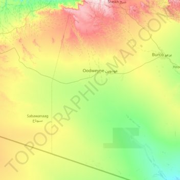
Name: Oodweyne District topographic map, elevation, terrain.
Location: Oodweyne District, Togdheer, Somaliland, Somalia (8.57202 44.69000 9.94019 45.29000)
Average elevation: 1,091 m
Minimum elevation: 767 m
Maximum elevation: 1,900 m
Other topographic maps
Click on a map to view its topography, its elevation and its terrain.
Burao
Somalia > Togdheer > Burao District
Burao, Burao District, Togdheer, Somalia
Average elevation: 1,051 m
Karasharka
Somalia > Togdheer > Burao District
Karasharka, Burao District, Togdheer, Somalia
Average elevation: 1,142 m
Dhummay
Somalia > Togdheer > Buhoodle District
Dhummay, Buhoodle District, Togdheer, Somaliland, Somalia
Average elevation: 802 m
Togdheer
Somalia > Togdheer > Burao District
Togdheer, Burao District, Togdheer, Somaliland, Somalia
Average elevation: 930 m