
Yedigöller topographic map
Interactive map
Click on the map to display elevation.
About this map
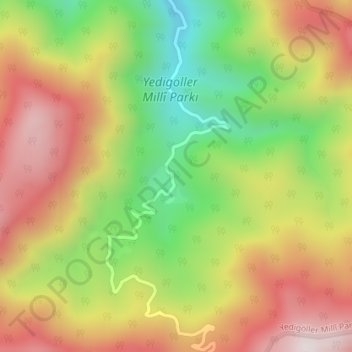
Name: Yedigöller topographic map, elevation, terrain.
Location: Yedigöller, Bolu, Bolu merkez, Bolu, Black Sea Region, Turkey (40.93332 31.73774 40.95332 31.75774)
Average elevation: 975 m
Minimum elevation: 622 m
Maximum elevation: 1,312 m
Other topographic maps
Click on a map to view its topography, its elevation and its terrain.