
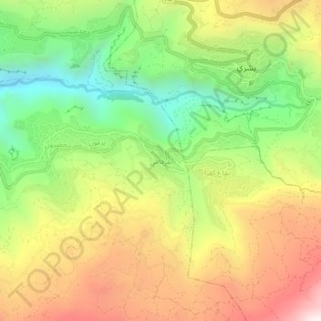
Bqerqacha topographic map
Interactive map
Click on the map to display elevation.
About this map
Name: Bqerqacha topographic map, elevation, terrain.
Location: Bqerqacha, Bsharri District, North Governorate, 1377, Lebanon (34.21904 35.97712 34.25904 36.01712)
Average elevation: 1,525 m
Minimum elevation: 957 m
Maximum elevation: 2,171 m
Other topographic maps
Click on a map to view its topography, its elevation and its terrain.
Bdebba
The town of Bdebba is located in the Qada’a of Koura in the North governorate at an average altitude of 900 feet (270 meters) above sea level. Bdebba is 45 miles (72 kilometers) north of Beirut 3.5 miles (5.6 kilometers) east of the Mediterranean sea and 6 miles (9.7 kilometers) south of Tripoli (Trablous)…
Average elevation: 283 m
Zgharta District
The district at elevations from 40–2,550 metres (130–8,370 ft), from near the coast to its highest point in the Mount Lebanon mountain range.
Average elevation: 527 m
Ehden
Ehden is located in the central northern side of Mount Lebanon, with a 1500-metre (at Midan square) elevation from sea level. It is 120 kilometres (75 mi) from Beirut, 30 kilometres (19 mi) from Tripoli and 25 kilometres (16 mi) from Zgharta. Ehden used to be the sole residence for Zghartians prior to the…
Average elevation: 1,350 m
Tripoli
The urban form of Mamluk Tripoli was dictated mainly by climate, site configuration, defense, and urban aesthetics. The layout of major thoroughfares was set according to prevailing winds and topography. The city had no fortifications, but heavy building construction characterized by compact urban forms,…
Average elevation: 42 m
Miniyeh
Miniyeh (Arabic: المنية, French: Minieh) is the capital of the Miniyeh-Danniyeh District in North Governorate of Lebanon. Minya is located 96 km from Beirut at an altitude of 20 m above sea level.
Average elevation: 30 m
Tannourine
Tannourine is the plural of the Syriac word tannour, which indicates an old stone oven. Tannourine's name may in fact stem from the local topography, which resembles the convex form of an oven called tannour, with the dual suffix ine as a reference to the two distinct areas of Tannourine Al-Tahta (literally…
Average elevation: 1,601 m
Mount Lebanon
Mount Lebanon (Arabic: جَبَل لُبْنَان, jabal lubnān, Lebanese Arabic pronunciation: [ˈʒabal lɪbˈneːn]; Syriac: ܛܘܪ ܠܒ݂ܢܢ, ṭūr leḇnān, Western Syriac pronunciation: [tˤur lewˈnɔn], ṭūr lewnōn French: Mont Liban) is a mountain range in Lebanon. It averages above 2,500 m…
Average elevation: 2,819 m
Bsharri
Bsharri (Arabic: بشرّي Bšarrī; Syriac: ܒܫܪܝ; also Romanized Becharre, Bcharre, Bsharre, (Bcharre El Arez بشرّي الارز) is a town at an altitude of about 1,450 m (4,760 ft) to 3,088 m (10,131 ft). It is located in the Bsharri District of the North Governorate in Lebanon. Bsharri is the town…
Average elevation: 1,847 m