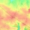
Bosquentin topographic map
Click on the map to display elevation.
Bosquentin
Altitude 170 m. La commune est située sur un plateau assez venteux.
About this map

Name: Bosquentin topographic map, elevation, terrain.
Average elevation: 154 m
Minimum elevation: 117 m
Maximum elevation: 182 m
Other topographic maps
Click on a map to view its topography, its elevation and its terrain.





















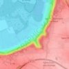
La Butte du Moulin
France > Normandie > Eure > Le Val-David > La Butte du Moulin
Average elevation: 132 m


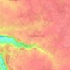
Saint-Pierre-de-Cormeilles
France > Normandie > Eure > Saint-Pierre-de-Cormeilles > Saint-Pierre-de-Cormeilles
Average elevation: 121 m


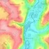






La Grand-Mare
France > Normandie > Eure > Sainte-Opportune-la-Mare > La Vallée
Average elevation: 30 m