
Le Grand-Saconnex topographic map
Interactive map
Click on the map to display elevation.
About this map
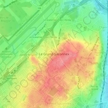
Name: Le Grand-Saconnex topographic map, elevation, terrain.
Location: Le Grand-Saconnex, Genf, 1218, Schweiz (46.22193 6.10089 46.25065 6.13603)
Average elevation: 429 m
Minimum elevation: 386 m
Maximum elevation: 471 m
Other topographic maps
Click on a map to view its topography, its elevation and its terrain.
Botanischer Garten
Botanischer Garten, Pâquis, Genf, Schweiz
Average elevation: 401 m
Pregny-Chambésy
Schweiz > Genf > Pregny-Chambésy
Pregny-Chambésy, Genf, 1292, Schweiz
Average elevation: 391 m
Collonge-Bellerive
Schweiz > Genf > Collonge-Bellerive
Collonge-Bellerive, Genf, Schweiz
Average elevation: 403 m