
Byam Martin Island topographic map
Interactive map
Click on the map to display elevation.
About this map
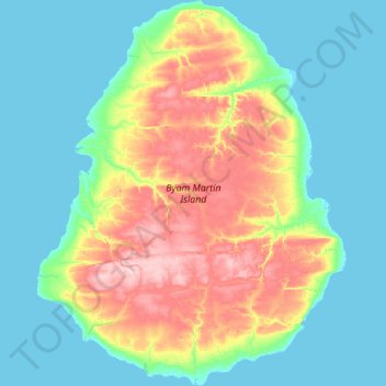
Name: Byam Martin Island topographic map, elevation, terrain.
Location: Byam Martin Island, Nunavut, Canadá (75.02275 -104.91450 75.44500 -103.58275)
Average elevation: 38 m
Minimum elevation: -2 m
Maximum elevation: 163 m
Other topographic maps
Click on a map to view its topography, its elevation and its terrain.