
Bylot Island topographic map
Interactive map
Click on the map to display elevation.
About this map
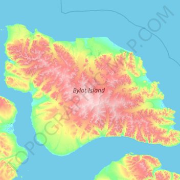
Name: Bylot Island topographic map, elevation, terrain.
Location: Bylot Island, Nunavut, Canadá (72.74019 -80.89484 73.76913 -76.05198)
Average elevation: 321 m
Minimum elevation: -7 m
Maximum elevation: 1,935 m
Other topographic maps
Click on a map to view its topography, its elevation and its terrain.