Geolocate

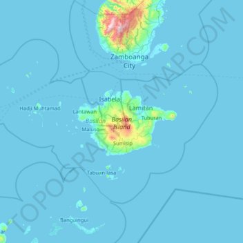
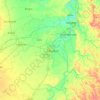
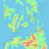
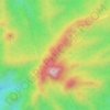
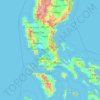
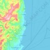
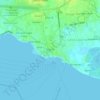
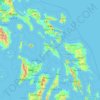
Basilan topographic map

Click on the map to display elevation.

Basilan

Basilan National Park is at the eastern portion of the remaining public forest between the city of Isabela and the municipalities of Lamitan, Tipo-Tipo and Sumisip. The park has an elevation of 971 metres (3,186 ft) above sea level, and the tallest peak, Puno Mahaji or Basilan Peak, dominates the park's landscape.

Wikipedia (CC-BY-SA 3.0)

About this map

Name: Basilan topographic map, elevation, terrain.

Location: Basilan, Bangsamoro, Philippines (6.15583 121.23429 7.04283 122.54308)

Average elevation: 32 m

Minimum elevation: -2 m

Maximum elevation: 1,310 m

Other topographic maps

Click on a map to view its topography, its elevation and its terrain.
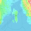
Samal Island

Philippines > Davao del Norte > Samal

Average elevation: 117 m

Quezon City

Philippines

Founded as a pueblo by Saint Pedro Bautista in 1590, San Francisco del Monte may be considered Quezon City's oldest district. The original land area of the old town of San Francisco del Monte was approximately2.5 square kilometres (1.0 sq mi) and covered parts of what is currently known as Project 7 and 8 and…

Average elevation: 57 m

Burgos

Philippines > Ilocos Norte

Another tourist attraction worth mentioning is the historic Cape Bojeador Lighthouse, built during the latter part of the 19th century. Facing the South China Sea, it serves as a beacon to passing ships and to local fishermen. Because of its high elevation, it offers travelers with a panoramic view of the…

Average elevation: 85 m

Tarlac

Philippines

Average elevation: 109 m

Cebu City

Philippines > Cebu > Cebu City

Average elevation: 140 m

Pinamungajan

Philippines > Cebu

Average elevation: 35 m

Burgos

Philippines > La Union

Average elevation: 319 m

Cauayan

Philippines > Isabela

Average elevation: 63 m

Panglao Island

Philippines > Bohol

Average elevation: 47 m

San Jose

Philippines > Nueva Ecija

The city of San Jose lies at 15° 47' North, 120° 59' East in Central Luzon. The estimated elevation at these coordinates is approximately 109.9 meters or 360.4 feet above mean sea level.

Average elevation: 175 m
Dinalupihan

Philippines > Bataan

Average elevation: 22 m

Bacolod

Philippines

Bacólod (English: Bacolod), is derived from bakólod (Old Spelling: bacólod), the Old Hiligaynon (Old Ilonggo) (Old Spelling: Ylongo and Ilongo) word for a "hill, turtle, mound, rise, hillock, down, any small eminence or elevation", since the resettlement was founded on a stony, hilly area, now the barangay…

Average elevation: 49 m

Keat

Philippines > Quirino

Average elevation: 735 m

San Isidro Iraya

Philippines > Albay > Malilipot

Average elevation: 54 m

Lawak Island

Philippines

Average elevation: 0 m

Can-avid

Philippines > Eastern Samar

Average elevation: 10 m

Bohol

Philippines

Average elevation: 116 m

Camiguin Island

Philippines > Camiguin

Average elevation: 51 m

Luta Del Norte

Philippines > Batangas > Malvar

Average elevation: 218 m

San Isidro

Philippines > Nueva Ecija

Average elevation: 19 m

Batulao

Philippines > Batangas > Nasugbu

Average elevation: 531 m

Liguasan Marsh

Philippines > Maguindanao

Average elevation: 9 m

Mintal

Philippines > Davao City

Average elevation: 130 m

Carcar

Philippines > Cebu

The land is generally level with less than 18% slope comprising 78.7% of the total land area. Areas with slopes ranging from 18 to 50% cover 19.3% of the total land area and those over 50% slope comprise approximately 1.9%. The highest recorded elevation is a little over 660 metres (2,170 ft) above sea level,…

Average elevation: 97 m
Mandaue

Philippines

It is one of the two (the other one being the municipality of Consolacion) local government units located within the mainland Metro Cebu where the elevation of land is less than 100 m (330 ft).

Average elevation: 109 m
Talavera

Philippines > Nueva Ecija

Average elevation: 41 m

Cordon

Philippines > Isabela

Average elevation: 130 m

Davao Gulf

Philippines

Average elevation: 0 m

Bato

Philippines > Camarines Sur

Average elevation: 13 m

Baluarte

Philippines > Nueva Ecija

Average elevation: 265 m

Tablas Strait

Philippines

Average elevation: 0 m

Samar

Philippines

Average elevation: 38 m

Cavite

Philippines

Average elevation: 77 m

Isabela

Philippines

Average elevation: 100 m

San Ildefonso

Philippines > Ilocos Sur

Average elevation: 9 m

Rizal

Philippines

Average elevation: 95 m

San Jose del Monte

Philippines > Bulacan

The elevation of the city ranges from approximately 40 to 900 meters (130 to 2,950 ft) above sea level; the relief transitions from warm lowland to cool upland as one goes eastward. This is because the city is part of the Sierra Madre mountain range. Plains and river valley flats characterize the western and…

Average elevation: 103 m
Tublay

Philippines > Benguet

According to the Philippine Statistics Authority, the municipality has a land area of 102.55 square kilometres (39.59 sq mi)  constituting 3.70% of the 2,769.08-square-kilometre- (1,069.15 sq mi) total area of Benguet. The topography is generally mountainous with an elevation of 1,400 metres (4,600 ft) above…

Average elevation: 1,256 m

Leyte Gulf

Philippines

Average elevation: 0 m

Balanga

Philippines > Bataan

Average elevation: 134 m

Iligan

Philippines

Average elevation: 229 m

Mangaldan

Philippines > Pangasinan

Average elevation: 6 m

Danao

Philippines > Cebu

Average elevation: 117 m

Angat

Philippines > Bulacan

Average elevation: 53 m

Ilagan

Philippines > Isabela

Abuan River is the main river of the Northern Sierra Madre Natural Park. It has an average elevation of 82 meters above sea level, and feeds the Abuan watershed in the city. Tourists and visitors can explore the diverse animal and plant life in one of the country’s remaining lush virgin forests. On January…

Average elevation: 123 m
Tagbilaran

Philippines > Bohol

Average elevation: 35 m

Vigan

Philippines > Ilocos Sur

Vigan is situated in a Quaternary Age sedimentary plain called the Vigan-Bantay Plain which is part of the Ilocos coastal plain. The Vigan-Bantay Plain is bounded on the east by a moderately rugged Miocene sediments consisting of interbedded sandstones and shale to very rugged Meta-volcanics and Meta sediment…

Average elevation: 63 m
Baguio

Philippines

In 1903, Filipinos, Japanese and Chinese workers were hired to build Kennon Road, the first road directly connecting Baguio with the lowlands of La Union and Pangasinan. Before this, the only road to Benguet was Naguilian Road, and it was largely a horse trail at higher elevations. Camp John Hay was…

Average elevation: 881 m
San Fernando

Philippines > Pampanga

Average elevation: 24 m

Malatgao River

Philippines > Palawan > Narra

Average elevation: 38 m

Maragusan

Philippines > Davao de Oro

Average elevation: 775 m

Patag Island

Philippines

Average elevation: 0 m

Kota Island

Philippines

Average elevation: 0 m

Lankiam Cay

Philippines

Average elevation: 0 m

Iriga

Philippines

Average elevation: 115 m

Placer

Philippines > Surigao Del Norte

Average elevation: 34 m

Surigao del Sur

Philippines

Average elevation: 274 m

Candaba

Philippines

Average elevation: 6 m

Davao City

Philippines

Average elevation: 65 m

Kinatihan II

Philippines

Average elevation: 22 m

Surigao River

Philippines > Surigao Del Norte > Sabang

Average elevation: 45 m

Ibabang Bukal

Philippines

Average elevation: 254 m

Cabatang

Philippines

Average elevation: 335 m

Pinget

Philippines

Average elevation: 1,430 m

Caloocan

Philippines

Average elevation: 81 m
Aurora Hill North Central

Philippines

Average elevation: 1,479 m

Besigan

Philippines

Average elevation: 584 m

Talomo River

Philippines

Average elevation: 201 m

Asin

Philippines

Average elevation: 1,321 m

Catambungan

Philippines

Average elevation: 5 m
Buenavista

Philippines

Average elevation: 112 m

Poliwes

Philippines

Average elevation: 1,397 m

Teodora Alonzo

Philippines

Average elevation: 1,459 m

Manggahan

Philippines

Average elevation: 7 m

Bakakeng Norte

Philippines

Average elevation: 1,379 m

Crossing Bayabas

Philippines

Average elevation: 22 m

Taguig

Philippines

Average elevation: 39 m

Marinduque

Philippines

Average elevation: 54 m

Bakakeng Central

Philippines

Average elevation: 1,412 m

Parañaque

Philippines

Average elevation: 14 m

Pasig

Philippines

Average elevation: 46 m

Pacdal

Philippines

Average elevation: 1,448 m

Macasandig

Philippines

Average elevation: 42 m

Batanes

Philippines

Average elevation: 26 m

Nueva Ecija

Philippines

Average elevation: 112 m

Nueva Vizcaya

Philippines

Average elevation: 107 m

Antique

Philippines

Average elevation: 46 m

Cebu

Philippines

Average elevation: 89 m

Zone IV

Philippines

Average elevation: 4 m

Albay

Philippines

Average elevation: 48 m

Sorsogon

Philippines

Average elevation: 40 m

Camarines Sur

Philippines

Average elevation: 56 m

Mines View

Philippines

Average elevation: 1,431 m

Masbate

Philippines

Average elevation: 54 m

Bulacan

Philippines

Average elevation: 105 m

City Camp Proper

Philippines

Average elevation: 1,430 m

Palawan

Philippines

Average elevation: 9 m

Gear up for your next adventure:

🧢Waterproof Hiking Hats - Keep the rain off your face while studying topographic maps
🎒Hiking Daypacks - Compact backpacks ideal for short hikes and excursions
🧗Locking Carabiners - Secure gear to your pack or for light technical use
🥾Hiking Boot Waterproofing Wax - Maintain the lifespan of your leather trekking boots
⛺Lightweight Tents - Compact tents for backpacking and trekking

As an Amazon Associate, this site earns from qualifying purchases at no extra cost to you.