
Make a donation
Gear up for your next adventure:
As an Amazon Associate, this site earns from qualifying purchases at no extra cost to you.
Kota Island topographic map
Click on the map to display elevation.
Make a donation
Gear up for your next adventure:
As an Amazon Associate, this site earns from qualifying purchases at no extra cost to you.
About this map
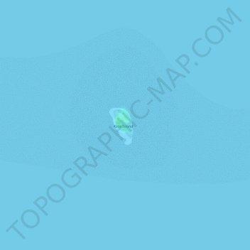
Name: Kota Island topographic map, elevation, terrain.
Location: Kota Island, Philippines (10.66525 114.42217 10.66927 114.42475)
Average elevation: 0 m
Minimum elevation: 0 m
Maximum elevation: 3 m
Make a donation
Gear up for your next adventure:
As an Amazon Associate, this site earns from qualifying purchases at no extra cost to you.
Other topographic maps
Click on a map to view its topography, its elevation and its terrain.
Manila
Almost all of Manila sits on top of centuries of prehistoric alluvial deposits built by the waters of the Pasig River and on some land reclaimed from Manila Bay. Manila's land has been altered substantially by human intervention, with considerable land reclamation along the waterfronts since the American…
Average elevation: 6 m
Make a donation
Gear up for your next adventure:
As an Amazon Associate, this site earns from qualifying purchases at no extra cost to you.
Malaybalay
The average elevation of the city is 622 metres (2,041 ft) above sea level. About 60% of the city's area has above 30% slope, characterized by steep hills, mountains, and cliff-like stream side. About 25% are level, gently sloping, and undulating. The rest are rolling and hilly.
Average elevation: 822 m
Batangas City
Philippines > Batangas > Batangas City
The city is the center of the radio listening market in Batangas, and is served by local radio stations, as well as some radio stations from Lipa and other parts of the Mega Manila area. The Roman Catholic Archdiocese of Lipa, through the Radyo Bayanihan System, hosts two local radio stations: ALFM 95.9 Radyo…
Average elevation: 108 m
Quezon City
Founded as a pueblo by Saint Pedro Bautista in 1590, San Francisco del Monte may be considered Quezon City's oldest district. The original land area of the old town of San Francisco del Monte was approximately2.5 square kilometres (1.0 sq mi) and covered parts of what is currently known as Project 7 and 8 and…
Average elevation: 57 m
Make a donation
Gear up for your next adventure:
As an Amazon Associate, this site earns from qualifying purchases at no extra cost to you.
Muntinlupa
There are three plausible origins of the name of the city: First, is its association with the thin topsoil in the area; second, residents, purportedly replying to a question by Spaniards in the 16th century what the name of their place was, said “Monte sa Lupa”—apparently mistaking the question for what…
Average elevation: 22 m
Make a donation
Gear up for your next adventure:
As an Amazon Associate, this site earns from qualifying purchases at no extra cost to you.
Digos
Philippines > Davao del Sur > Digos
The land topography of Digos City ranges from hilly to mountainous in the north-northeast portion and flat and slightly rolling at the coastal barangays, while the urban area and the surrounding barangays in the south portion are generally flat. Generally, climate in Digos falls under the fourth type while…
Average elevation: 152 m
Make a donation
Gear up for your next adventure:
As an Amazon Associate, this site earns from qualifying purchases at no extra cost to you.
Make a donation
Gear up for your next adventure:
As an Amazon Associate, this site earns from qualifying purchases at no extra cost to you.
Negros
Philippines > Negros Occidental > Himamaylan
Siquijor is an island located southeast of Negros Oriental. Area-wise, it is the third smallest in the country, with an area of 343.5 square kilometers (132.6 sq mi). Mount Malabahoc, also known as Mount Bandila‑an, is the highest point of the island, with its elevation reaching 628 meters (2,060 ft) above…
Average elevation: 210 m
San Jose del Monte
Philippines > Bulacan > San Jose del Monte
The elevation of the city ranges from approximately 40–900 meters above sea level; the relief transitions from warm lowland to cool upland as one goes eastward. This is because the city is part of the Sierra Madre mountain range. Plains and river valley flats characterize the western and southwestern…
Average elevation: 106 m
Make a donation
Gear up for your next adventure:
As an Amazon Associate, this site earns from qualifying purchases at no extra cost to you.
Antipolo
Its higher elevation than that of Metro Manila affords it a scenic view of the metropolis, especially at night. Its locally grown mangoes and cashews are popular among tourists, as well as suman – a local delicacy made out of glutinous rice. The Hinulugang Taktak National Park, which was once a popular…
Average elevation: 125 m
Make a donation
Gear up for your next adventure:
As an Amazon Associate, this site earns from qualifying purchases at no extra cost to you.
Zamboanga del Norte
It has an average elevation of 243.8 metres (800 ft), with Mount Dabiak in Katipunan as the highest peak at 2,600 metres (8,500 ft). Other parts, near the coastlines, are plains. The province's irregular coastline runs some 400 kilometres (250 mi) from north to south.
Average elevation: 78 m
Make a donation
Gear up for your next adventure:
As an Amazon Associate, this site earns from qualifying purchases at no extra cost to you.
Zamboanga Peninsula
Pagadian is known as the "Little Hong Kong of the South" because of its topographical feature that is reminiscent of Hong Kong. It also has an affluent Chinese community that officially celebrates the Chinese Lunar New Year.
Average elevation: 64 m
Make a donation
Gear up for your next adventure:
As an Amazon Associate, this site earns from qualifying purchases at no extra cost to you.
Baybay
The climate is of Coronas Climate type IV, which is generally wet with no particularly discernible seasons. Its topography is generally mountainous in the eastern portion as it slopes down west towards the shore line. Generally an agricultural city, the common means of livelihood are farming and fishing. Some…
Average elevation: 157 m
Make a donation
Gear up for your next adventure:
As an Amazon Associate, this site earns from qualifying purchases at no extra cost to you.
Make a donation
Gear up for your next adventure:
As an Amazon Associate, this site earns from qualifying purchases at no extra cost to you.
Manila
Almost all of Manila sits on top of centuries of prehistoric alluvial deposits built by the waters of the Pasig River and on some land reclaimed from Manila Bay. Manila's land has been altered substantially by human intervention, with considerable land reclamation along the waterfronts since the American…
Average elevation: 13 m
Ayala Westgrove Heights
Philippines > Cavite > Puting Kahoy > Ayala Westgrove Heights
Average elevation: 161 m
Make a donation
Gear up for your next adventure:
As an Amazon Associate, this site earns from qualifying purchases at no extra cost to you.
Make a donation
Gear up for your next adventure:
As an Amazon Associate, this site earns from qualifying purchases at no extra cost to you.
Marawi
Marawi is located upon the shores of Lake Lanao. It is primarily inhabited by the Maranao people. The city is also called the "summer capital of the south" due to its higher elevation and cooler climate, a nickname it shares with Malaybalay.
Average elevation: 707 m
Make a donation
Gear up for your next adventure:
As an Amazon Associate, this site earns from qualifying purchases at no extra cost to you.
Corregidor Island
Philippines > Cavite > Cavite City
The tadpole-shaped island, with its tail running eastward, is about 6.5 km (4.0 mi) long, about 2.0 km (1.2 mi) wide at its widest with a total land area of about 900 hectares (2,200 acres). The highest elevation is at 180 m (590 ft) on the Topside.[5] The island is divided into four sections.
Average elevation: 11 m
Make a donation
Gear up for your next adventure:
As an Amazon Associate, this site earns from qualifying purchases at no extra cost to you.
Make a donation
Gear up for your next adventure:
As an Amazon Associate, this site earns from qualifying purchases at no extra cost to you.
Make a donation
Gear up for your next adventure:
As an Amazon Associate, this site earns from qualifying purchases at no extra cost to you.
Make a donation
Gear up for your next adventure:
As an Amazon Associate, this site earns from qualifying purchases at no extra cost to you.
Make a donation
Gear up for your next adventure:
As an Amazon Associate, this site earns from qualifying purchases at no extra cost to you.
Make a donation
Gear up for your next adventure:
As an Amazon Associate, this site earns from qualifying purchases at no extra cost to you.
Rajah Sikatuna Protected Landscape
Philippines > Bohol > San Isidro
The Rajah Sikatuna park occupies the low mountain range in the south of Bohol island which corresponds geographically with the municipalities of Carmen, Sierra Bullones, Garcia Hernandez, Valencia, Dimiao, Bilar , Loboc and Batuan. It is characterized by rolling hills with remnants of natural forest on steep…
Average elevation: 349 m
Make a donation
Gear up for your next adventure:
As an Amazon Associate, this site earns from qualifying purchases at no extra cost to you.
Ilagan
Abuan River is the main river of the Northern Sierra Madre Natural Park. It has an average elevation of 82 meters above sea level, and feeds the Abuan watershed in the city. Tourists and visitors can explore the diverse animal and plant life in one of the country’s remaining lush virgin forests. On January…
Average elevation: 123 m
Make a donation
Gear up for your next adventure:
As an Amazon Associate, this site earns from qualifying purchases at no extra cost to you.
Mounts Banahaw–San Cristobal Protected Landscape
Philippines > Laguna > Nagcarlan
Average elevation: 707 m
Make a donation
Gear up for your next adventure:
As an Amazon Associate, this site earns from qualifying purchases at no extra cost to you.
Nabua
Nabua has about 8,803.0600 hectares or 99.42% very low elevation or less than 100 meters elevation and remaining 51.3593 hectares or 0.58% of low elevation or between 100 and 300 meters elevation. Its slope covers about 7,927.3616 hectares or 89.53% which are level to nearly level (0-3%) while the remaining…
Average elevation: 27 m
Make a donation
Gear up for your next adventure:
As an Amazon Associate, this site earns from qualifying purchases at no extra cost to you.
Make a donation
Gear up for your next adventure:
As an Amazon Associate, this site earns from qualifying purchases at no extra cost to you.