Geolocate

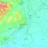
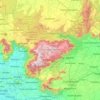
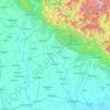
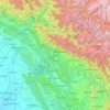
Assam topographic map

Click on the map to display elevation.

About this map
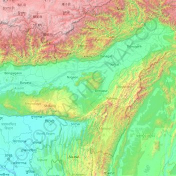
Name: Assam topographic map, elevation, terrain.

Location: Assam, India (24.13603 89.69860 27.97124 96.01244)

Average elevation: 1,142 m

Minimum elevation: -2 m

Maximum elevation: 7,324 m

Other topographic maps

Click on a map to view its topography, its elevation and its terrain.
Pune

India > Maharashtra > Pune City Subdistrict

Average elevation: 641 m

Bhubaneshwar

India > Odisha > Bhubaneswar (M.Corp.)

Bhubaneswar is in Khordha district of Odisha. It is in the eastern coastal plains, along the axis of the Eastern Ghats mountains. The city has an average altitude of 45 m (148 ft) above sea level. It lies southwest of the Mahanadi River that forms the northern boundary of Bhubaneswar metropolitan area, within…

Average elevation: 30 m

Sagar Island

India > West Bengal

Average elevation: 2 m

Chuzhuppu

India > Kerala > Peerumade > Peruvanthanam

Average elevation: 308 m

Gujarat

India

Average elevation: 124 m

Maharashtra

India > Maharashtra

Maharashtra is the third largest state by area in India. The Western Ghats better known as Sahyadri, are a hilly range running parallel to the coast, at an average elevation of 1,200 metres (4,000 ft). Kalsubai, a peak in the Sahyadris, near Nashik city is the highest elevated point in Maharashtra. To the west…

Average elevation: 478 m
Sinhagad Fort

India > Maharashtra > Kalyan Gaon

Average elevation: 995 m

Thiruvananthapuram

India > Kerala > Thiruvananthapuram

Thiruvananthapuram is built on seven hills by the seashore and is at 8°30′N 76°54′E / 8.5°N 76.9°E / 8.5; 76.9 on the west coast, near the southern tip of mainland India. The city is on the west coast of India and is bounded by the Laccadive Sea to its west and the Western Ghats to its east.…

Average elevation: 33 m

Bhalki

India > Karnataka > Bhalki taluku > Bhalki

Bhalki is located at 18°02′N 77°13′E / 18.03°N 77.22°E / 18.03; 77.22. It has an average elevation of 587 metres (1925 feet).

Average elevation: 589 m
Ahmedabad

India > Gujarat

Average elevation: 50 m

Pagdaa

India > Ladakh

Average elevation: 5,709 m

Puluchan

India > Ladakh

Average elevation: 3,641 m

Om Parvat

India

Om Parvat is a mountain located in Pithoragarh district of the Uttarakhand, India. Om Parvat's peak elevation is 5,590 m (18,340 ft) above sea level.

Average elevation: 5,207 m

Spangmik

India

Average elevation: 4,405 m

Dzo Jongo West

India

Average elevation: 5,855 m

Thukje

India

Average elevation: 4,641 m

Turtuk

India

Average elevation: 3,284 m

Muntho Dhalo

India

Average elevation: 4,847 m

Yaldor

India

Average elevation: 3,795 m

Lungser Kangri

India

Average elevation: 6,269 m

Chushul

India

Average elevation: 4,391 m

South Rimo Glacier

India

Average elevation: 5,588 m

Underi

India

Average elevation: 0 m

Kiari

India

Average elevation: 4,267 m

South Pullu

India

Average elevation: 4,859 m

Anamudi

India > Kerala > Devikulam

Anamudi ("Elephant head") is a mountain located in Ernakulam district and Idukki district of the Indian state of Kerala. With an elevation of 2,695 metres (8,842 ft) and a topographic prominence of 2,479 metres (8,133 ft), it is the highest peak in the Western Ghats and in South India.

Average elevation: 2,204 m

Kanyakumari

India > Tamil Nadu

Average elevation: 79 m

Vishalgad

India > Maharashtra > Shahuwadi

Average elevation: 508 m

Ajinkyatara Fort

India > Maharashtra > Satara > Satara

Ajinkyatara Fort, also known as the "Fort of the Sapta-Rishi," is a historical hill fort located on Ajinkyatara Mountain, one of the seven mountains surrounding the city of Satara in the Sahyadri Mountains of Maharashtra, India. Situated at an altitude of 3,300 feet, the fort overlooks Satara City and is…

Average elevation: 764 m

Hemis

India

Average elevation: 5,218 m

Karzok

India

Average elevation: 4,618 m

The Nilgiris

India > Tamil Nadu

Average elevation: 639 m

Piram Bet

India

Average elevation: 14 m

Indore

India > Madhya Pradesh > Juni Indore Tahsil

Indore /ɪnˈdɔːr/ (listen) is the most populous and the largest city in the Indian state of Madhya Pradesh. It serves as the headquarters of both Indore District and Indore Division. It is also considered as an education hub of the state and has campuses of both the Indian Institute of Technology and the…

Average elevation: 555 m
Nashik

India > Maharashtra

Average elevation: 555 m

Dewas

India > Madhya Pradesh

Average elevation: 465 m

Jaipur

India > Rajasthan > Jaipur Tehsil

Average elevation: 408 m

Parta

India > Ladakh

Average elevation: 5,389 m

Phokto Scheyok

India > Ladakh

Average elevation: 5,830 m

Changlung

India > Ladakh

Average elevation: 3,612 m

Jadcherla

India > Telangana > Jadcherla mandal

Jadcherla is located at 16°46′26″N 78°08′12″E / 16.7738°N 78.1367°E / 16.7738; 78.1367 and at an altitude of 14 m (46 ft). The town is spread over an area of 550 km2 (210 sq mi). Jadcherla is located 86 km from Hyderabad 130km from Kurnool and 21 km from Mahabubnagar.

Average elevation: 552 m
Gorelli

India > Telangana

Average elevation: 460 m

Tirthpuri

India > Maharashtra > Ghansawangi

Average elevation: 439 m

Valarpuram

India > Tamil Nadu

Average elevation: 42 m

Rewalsar

India > Himachal Pradesh > Mandi

Rewalsar is located at an altitude of 1360 m above sea level. It is connected to Mandi by a motorable road and is about 25 km from Mandi. Lying in the Southern Himalayan belt, winters in Rewalsar can be freezing, while summers are generally pleasant.

Average elevation: 1,283 m

Uran

India > Maharashtra > Uran Subdistrict

Uran is located at 18°53′N 72°56′E / 18.88°N 72.94°E / 18.88; 72.94. Uran is at an average elevation of 21 metres (69 ft).

Average elevation: 10 m
Sirohi

India > Rajasthan

Average elevation: 315 m

Chumathang

India > Ladakh

Average elevation: 4,335 m

Janjira Fort

India > Murud > Rajapuri

Average elevation: 9 m

Bijnor

India > Uttar Pradesh

Average elevation: 482 m

Ramnathapuram

India > Tamil Nadu

Average elevation: 59 m

Edulabad

India > Telangana > Ghatkesar mandal

Average elevation: 454 m

Vinchhiya

India > Gujarat > Vinchhiya Taluka

Average elevation: 173 m

Kanichar

India > Kerala > Iritty

Average elevation: 105 m

Periya

India > Kerala > Mananthavady

Average elevation: 774 m

Padur

India > Tamil Nadu

Average elevation: 5 m

Bhatsa

India > Maharashtra

Average elevation: 130 m

Pallikaranai Marsh

India > Tamil Nadu > Chennai

Average elevation: 2 m

Raigad Fort

India > Maharashtra > Mahad Taluka > Hirkaniwadi

Average elevation: 448 m

Cheyyar River

India > Tamil Nadu

Average elevation: 181 m

Kangsabati River

India > West Bengal

Average elevation: 100 m

Kothamangalam

India > Kerala > Kothamangalam

Kothamangalam is situated in the eastern part of the Ernakulam district. According to the division of the geographical regions of Kerala, Kothamangalam is in a mid-land region. The general topography is hilly.

Average elevation: 34 m
Igatpuri

India > Maharashtra > Igatpuri

Average elevation: 600 m

Bidar

India > Karnataka

Average elevation: 536 m

Mangaluru

India > Karnataka > Mangaluru taluk

Mangalore is also the administrative headquarters of the Dakshina Kannada district; it is a commercial, industrial, educational, healthcare, and startup hub. The city's international airport is the second-largest and second-busiest airport in Karnataka. Mangalore City Corporation is responsible for the civic…

Average elevation: 25 m
Jalgaon

India > Maharashtra

Average elevation: 360 m

Chamoli

India > Uttarakhand

Average elevation: 3,472 m

Chandrapur

India > Maharashtra

Average elevation: 243 m

Madikeri

India > Karnataka > Madikeri taluku

Madikeri features a tropical highland climate as it has an elevation of 1,170 m (3,840 ft). Madikeri is located at 12°25′N 75°44′E / 12.42°N 75.73°E / 12.42; 75.73. Madikeri lies in the Western Ghats and is a popular hill station. The nearest cities are Hassan to the north, Mangaluru to the…

Average elevation: 1,054 m
Kangra

India > Himachal Pradesh

Average elevation: 1,665 m

Surat

India > Gujarat > Katargam Taluka > Surat

Surat is a port city situated on the banks of the Tapi river. Damming of the Tapi caused the original port facilities to close; the nearest port is now in the Magadalla and Hazira area of Surat Metropolitan Region.It has famous beach called 'Dumas Beach' located in Hazira. The city is located at 21°10′N…

Average elevation: 11 m

Kopni

India > Ladakh

Average elevation: 4,672 m

Jambulmal

India > Maharashtra

Average elevation: 256 m

Changchenmo

India > Ladakh

Average elevation: 6,051 m

Nangtase

India > Ladakh

Average elevation: 5,430 m

Pidmu

India > Ladakh

Average elevation: 4,537 m

Changlung

India > Ladakh

Average elevation: 5,165 m

Gonbo Rangjon

India > Ladakh

Average elevation: 4,759 m

Chulungkha

India > Ladakh

Average elevation: 3,422 m

Laskerguda

India > Telangana

Average elevation: 458 m

Maravamangalam

India > Tamil Nadu > Sivaganga

Average elevation: 49 m

Narenderraopet

India > Telangana

Average elevation: 105 m

Kundi

India > Haryana > Panchkula

Average elevation: 317 m

Yadaram

India > Telangana

Average elevation: 588 m

Stok

India > Ladakh

Average elevation: 3,580 m

Stakna

India > Ladakh

Average elevation: 3,324 m

Chushot Gongma

India > Ladakh

Average elevation: 3,272 m

Chuchot Yokma

India > Ladakh

Average elevation: 3,272 m

Saspul

India > Ladakh

Average elevation: 3,278 m

Phey

India > Ladakh

Average elevation: 3,269 m

Skidmang

India > Ladakh

Average elevation: 4,358 m

Nurnis

India > Ladakh

Average elevation: 4,292 m

Keshar

India > Ladakh

Average elevation: 4,360 m

Kesar

India > Ladakh

Average elevation: 5,563 m

Tirido

India > Ladakh

Average elevation: 4,123 m

Hymia

India > Ladakh

Average elevation: 4,122 m

Gorai

India > Maharashtra

Average elevation: 5 m

Bhairamgarh

India > Chhattisgarh

Average elevation: 346 m

Mudimiyal

India > Telangana

Average elevation: 612 m

Gear up for your next adventure:

🧘Folding Sit Mats - Dry and warm seat for map-reading breaks on damp ground
🥾Hiking Boot Waterproofing Wax - Maintain the lifespan of your leather trekking boots
👟Women's Trail Running Shoes - Agile footwear for fell running and technical trails
🧣Fleece Neck Warmers - Extra insulation for winter topographic surveys
🌄Outdoor Binoculars - Compact binoculars for landscape observation

As an Amazon Associate, this site earns from qualifying purchases at no extra cost to you.