
Refrancore topographic map
Interactive map
Click on the map to display elevation.
About this map
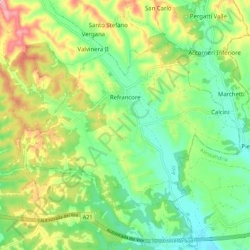
Name: Refrancore topographic map, elevation, terrain.
Location: Refrancore, Asti, Piamonte, Italia (44.91109 8.30134 44.94885 8.38054)
Average elevation: 167 m
Minimum elevation: 117 m
Maximum elevation: 249 m
Other topographic maps
Click on a map to view its topography, its elevation and its terrain.