
Cisterna d'Asti topographic map
Interactive map
Click on the map to display elevation.
About this map
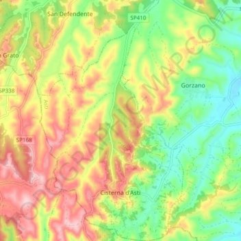
Name: Cisterna d'Asti topographic map, elevation, terrain.
Location: Cisterna d'Asti, Asti, Piamonte, Italia (44.81429 7.97895 44.86763 8.02428)
Average elevation: 265 m
Minimum elevation: 169 m
Maximum elevation: 374 m
Other topographic maps
Click on a map to view its topography, its elevation and its terrain.