Geolocate

Al Hajir topographic map

Interactive map

Click on the map to display elevation.

About this map

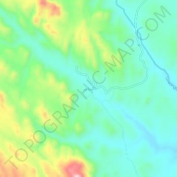
Name: Al Hajir topographic map, elevation, terrain.

Location: Al Hajir, محافظة ظهران الجنوب, Asir, Arabie saoudite (17.48169 43.60182 17.52169 43.64182)

Average elevation: 2,084 m

Minimum elevation: 1,998 m

Maximum elevation: 2,291 m

Other topographic maps

Click on a map to view its topography, its elevation and its terrain.

محافظة البرك

Arabie saoudite > Asir

محافظة البرك, Asir, Arabie saoudite

Average elevation: 186 m

Um al-Baidh

Arabie saoudite > Asir

Um al-Baidh, محافظة البرك, Asir, Arabie saoudite

Average elevation: 88 m

جرجرة

Arabie saoudite > Asir

جرجرة, محافظة محايل, Asir, Arabie saoudite

Average elevation: 1,531 m

Yala

Arabie saoudite > Asir

Yala, محافظة بيشه, Asir, Arabie saoudite

Average elevation: 1,292 m