
Tharke topographic map
Interactive map
Click on the map to display elevation.
About this map
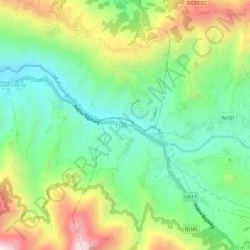
Name: Tharke topographic map, elevation, terrain.
Location: Tharke, Naubise, Dhunibesi, Dhading, Bagmati Pradesh, Nepal (27.71656 85.10966 27.75656 85.14966)
Average elevation: 970 m
Minimum elevation: 693 m
Maximum elevation: 1,448 m
Other topographic maps
Click on a map to view its topography, its elevation and its terrain.
Sarketari Baandh/ Risk And Hazards/ Flood
Nepal > Dhading > Dhading Besi
Sarketari Baandh/ Risk And Hazards/ Flood, Nilkantha Municipality Ward No. 4, Dhading Besi, Nilakantha, Dhading, Bagmati Pradesh, Nepal
Average elevation: 933 m
Dhading Besi
Dhading Besi, Nilakantha, Dhading, Bagmati Pradesh, Nepal
Average elevation: 873 m