
Byumba topographic map
Interactive map
Click on the map to display elevation.
About this map
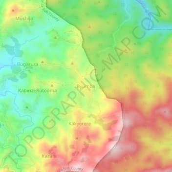
Name: Byumba topographic map, elevation, terrain.
Location: Byumba, Kayonza Sub-County, Kanungu, Western Region, Uganda (-0.94665 29.67451 -0.90665 29.71451)
Average elevation: 1,489 m
Minimum elevation: 1,315 m
Maximum elevation: 1,688 m
Other topographic maps
Click on a map to view its topography, its elevation and its terrain.