Kumlinge topographic map
Interactive map
Click on the map to display elevation.
About this map
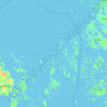
Name: Kumlinge topographic map, elevation, terrain.
Location: Kumlinge, Ålands Archipelago, Åland Islands, 22820, Finland (60.10755 20.10614 60.80257 20.98578)
Average elevation: 2 m
Minimum elevation: -5 m
Maximum elevation: 118 m
Other topographic maps
Click on a map to view its topography, its elevation and its terrain.
Torsholma
Finland > Åland Islands > Brändö
Torsholma, Brändö, Ålands Archipelago, Åland Islands, Finland
Average elevation: 2 m
Hammarland
Hammarland, Ålands Countryside, Åland Islands, 22240, Finland
Average elevation: 3 m
Orrdalsklint
Orrdalsklint, Saltvik, Ålands Countryside, Åland Islands, Finland
Average elevation: 57 m
Husö
Husö, Sottunga, Ålands Archipelago, Åland Islands, Finland
Average elevation: 1 m
Mariehamn sub-region
Mariehamn sub-region, Åland Islands, Finland
Average elevation: 7 m