Geolocate

Shimoni topographic map

Interactive map

Click on the map to display elevation.

About this map

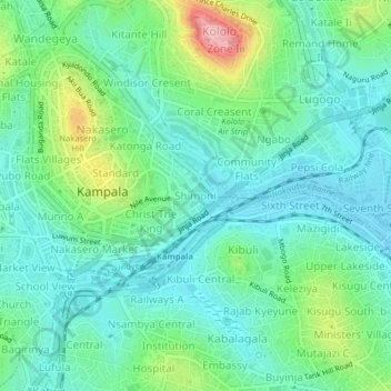
Name: Shimoni topographic map, elevation, terrain.

Location: Shimoni, Kampala, Central Region, Uganda (0.29728 32.57088 0.33728 32.61088)

Average elevation: 1,182 m

Minimum elevation: 1,141 m

Maximum elevation: 1,301 m

Other topographic maps

Click on a map to view its topography, its elevation and its terrain.

Kikandwa

Uganda > Central Region > Kampala

Average elevation: 1,191 m

Isreal-matovu

Uganda > Central Region > Kampala

Average elevation: 1,187 m

Bahai

Uganda > Central Region > Kampala

Average elevation: 1,200 m

Kawempe

Uganda > Central Region > Kampala

Average elevation: 1,196 m

Rubaga

Uganda > Central Region > Kampala

Average elevation: 1,187 m

Central

Uganda > Central Region > Kampala

Average elevation: 1,193 m