
Montabone topographic map
Interactive map
Click on the map to display elevation.
About this map
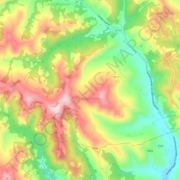
Name: Montabone topographic map, elevation, terrain.
Location: Montabone, Asti, Piémont, Italie (44.68602 8.36251 44.71526 8.42055)
Average elevation: 335 m
Minimum elevation: 178 m
Maximum elevation: 497 m
Other topographic maps
Click on a map to view its topography, its elevation and its terrain.