
Otta topographic map
Interactive map
Click on the map to display elevation.
About this map
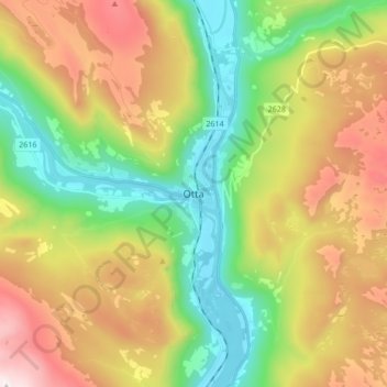
Name: Otta topographic map, elevation, terrain.
Location: Otta, Sel, Innlandet, 2670, Norwegen (61.73124 9.49525 61.81124 9.57525)
Average elevation: 719 m
Minimum elevation: 280 m
Maximum elevation: 1,364 m
Other topographic maps
Click on a map to view its topography, its elevation and its terrain.
Søndre Land
Søndre Land, Innlandet, Norwegen, Trollstigen
Average elevation: 459 m
Brumunddal
Brumunddal, Ringsaker, Innlandet, 2382, Norwegen
Average elevation: 259 m
Skeikampen
Skeikampen, Gausdal, Innlandet, 2652, Norwegen
Average elevation: 918 m
Skandinavisches Gebirge
Skandinavisches Gebirge, Lom, Innlandet, Norwegen
Average elevation: 2,050 m