
Sivilla topographic map
Interactive map
Click on the map to display elevation.
About this map
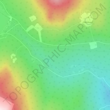
Name: Sivilla topographic map, elevation, terrain.
Location: Sivilla, Tynset, Innlandet, Norwegen (62.21534 10.51987 62.23233 10.57175)
Average elevation: 730 m
Minimum elevation: 577 m
Maximum elevation: 999 m
Other topographic maps
Click on a map to view its topography, its elevation and its terrain.
Søndre Land
Søndre Land, Innlandet, Norwegen, Trollstigen
Average elevation: 459 m
Brumunddal
Brumunddal, Ringsaker, Innlandet, 2382, Norwegen
Average elevation: 259 m
Skeikampen
Skeikampen, Gausdal, Innlandet, 2652, Norwegen
Average elevation: 918 m
Skandinavisches Gebirge
Skandinavisches Gebirge, Lom, Innlandet, Norwegen
Average elevation: 2,050 m